Eight Dead After Army-Chartered Plane Goes Down in Dense Fog Near Remote Alaska Radar Installation
Sandego.net – All eight occupants of a twin-engine charter aircraft were killed Thursday afternoon when the plane struck terrain near a secluded Air Force airstrip in western Alaska, federal aviation authorities and military officials confirmed. The crash occurred in thick fog conditions that had reduced visibility to under 800 feet, forcing pilots to navigate by instruments alone during their final approach to the runway.
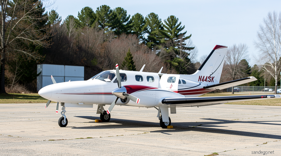
The aircraft, a Cessna 441 Conquest II operated by Security Aviation, had departed Anchorage bound for Cape Newenham Airport roughly 450 miles to the southwest. Preliminary data from the Federal Aviation Administration places the time of impact at approximately 12:15 p.m. local time on Thursday. The flight was chartered by the US Army Corps of Engineers to transport personnel to and from a Long Range Radar Site in the region.
Who Was on Board
Clint Johnson, the National Transportation Safety Board’s Alaska region chief, identified the eight victims as two pilots, two Army Corps of Engineers employees, and four contractors. The Air Force confirmed that search-and-rescue teams reached the wreckage and found no survivors. Names of the deceased will be made public once next of kin have been notified, the Air Force stated.
The US Army Corps of Engineers’ Alaska District acknowledged in a brief statement that one of its chartered flights had crashed and that two USACE employees were among those killed.
A Strategic Radar Node in Isolated Terrain
Cape Newenham Airport is not a civilian facility. It is an Air Force gravel runway that serves exclusively as an access point to a Long Range Radar Site, part of a broader military early-warning network tasked with monitoring aircraft movements along the borders of Alaskan airspace. Only military aircraft and specifically approved charter flights are permitted to land there. The radar infrastructure itself is maintained by military contractors, making the charter flight a routine logistical operation for the installation.
The geography around the airstrip is unforgiving. FAA mapping data shows the gravel runway measures nearly 4,000 feet in length and sits on the slope of a mountain exceeding 2,300 feet in elevation. High terrain flanks both sides of the strip and rises sharply at the south end, meaning that once a pilot passes a certain point on approach, abandoning the landing becomes practically impossible. The wreckage was located approximately one-third of a mile west of runway 15, in an area of rising mountainous terrain, Johnson noted.
The Final Minutes: A Missed Approach in Whiteout Conditions
A preliminary NTSB review of radar and air-traffic-control data conducted Friday revealed the sequence of events. The pilots initiated at least one landing attempt on the south runway but were unable to complete it. They executed a missed approach, entered a holding pattern, and began a second descent. The accident occurred during that second approach.
“There was at least one approach that was attempted,” Johnson said. “It ended in a missed approach. (The plane) went back, held for a while, and then started a second approach. And that’s when the accident happened.”
National Weather Service observations recorded fog at the landing strip around the time of the crash. Just before noon, visibility had dropped below 800 feet. Under those conditions, the pilots were dependent entirely on the aircraft’s onboard instruments, including GPS, for spatial reference while preparing to land, Johnson explained. After the first approach was aborted, air-traffic controllers lost contact with the aircraft. They were subsequently informed the plane had not reached the airport.
Investigation and Official Response
The NTSB will lead the investigation, with the FAA participating. A six-member accident investigation team was en route to Cape Newenham as of Friday, a logistical undertaking complicated by the extreme remoteness of the site. NTSB investigations of this nature typically require one to two years before a probable cause is determined.
US Air Force Lt. Gen. Robert Davis addressed the loss in a formal statement:
“This is a devastating loss for our military family and the communities we serve. These individuals were dedicated professionals carrying out a vital mission in a demanding environment.”
Security Aviation issued its own statement expressing grief and pledging cooperation with investigators:
“Our hearts go out to the families, friends and loved ones of those who were lost. We will not speculate about the circumstances or potential cause and will defer questions regarding the investigation to the agencies leading that work.”
Alaska’s Political and Operational Context
Alaska Senator Lisa Murkowski voiced condolences in a post on X, noting her personal familiarity with the airline’s operations across the state.
“I’ve traveled extensively with Security Aviation throughout Alaska, and have met many of their experienced pilots,” Murkowski wrote. “I appreciate the U.S. Coast Guard, NTSB, Alaska State Troopers, and the Rescue Coordination Center for responding to the site. Alaska is praying for those on board, their loved ones, and the team at Security Aviation.”
Security Aviation markets its fleet of Cessna Conquest aircraft as well suited to Alaskan flying conditions, including challenging weather and remote airport environments. The twin-engine turbo-prop type is pressurized, accommodates up to nine passengers, and can cruise at 330 mph at an altitude of 28,000 feet, according to the company’s own published specifications. The aircraft’s pressurized cabin and twin-engine redundancy are designed to handle the variable conditions common to western Alaska’s interior and coastal routes, where weather can shift rapidly and alternate landing options are scarce.
The crash underscores the persistent operational risks faced by personnel supporting remote military installations across Alaska’s vast, sparsely populated landscape, where a single weather event can transform a routine short-haul charter into a fatal encounter with mountain terrain.
Related Reading
Frequently Asked Questions
What is Charter plane crashes in fog while?
Charter plane crashes in fog while is the main topic of this guide. The article explains the context, practical details, and next steps readers should understand.
Why does Charter plane crashes in fog while matter?
Charter plane crashes in fog while matters because readers are looking for a useful answer, not just a short summary. Good content should match search intent and help them decide what to do next.