
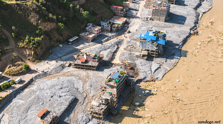
Nepal’s Deadly August Floods Expose the Cost of Abandoning Mountain Hazard Monitoring
Sandego.net – On the morning of August 26, a massive glacier breakup combined with a rock avalanche high in the Himalayas unleashed a torrent of fast-moving floodwater that swept through communities in both Nepal and China. More than 1,100 people lost their lives in the catastrophe. In the aftermath, questions have surfaced about what monitoring infrastructure existed — or failed to exist — to give downstream populations even a brief window of warning before the waters arrived.
The answer, in part, traces back to a quiet administrative decision made months earlier. In late January 2025, the Trump administration issued a stop-work notice that severed funding for Project SERVIR-Hindu Kush Himalaya, a long-running effort to map and track landslide-prone zones across the Nepali highlands. The program had been operational since 2010, and its contract was originally scheduled to run through 2026. It was terminated abruptly, with no transition period for winding down active research or transferring data pipelines to successor organizations.
A Program Built to See Danger Coming
Project SERVIR-Hindu Kush Himalaya was a collaborative initiative involving NASA, the US Agency for International Development (USAID), and the International Center for Integrated Mountain Development (ICIMOD). Its core mission was to build what researchers call “landslide situational awareness” — the capacity to detect slope motion, correlate extreme rainfall events with terrain instability, and generate forecasts that could reach vulnerable communities before a failure occurred.
Birendra Bajracharya, who served as the project’s director, explained that the funding cut halted work on slope-motion detection systems designed to feed into landslide forecasting models. He also noted that flood inundation mapping — the process of modeling where and how far floodwaters would spread after a triggering event — ceased operations entirely. Some data streams the project had initiated, including streamflow prediction for major regional rivers and forest fire monitoring, continue to function, but the broader hazard-detection architecture was left incomplete.
“We got the stop work notice around the end of January 2025,” Bajracharya said.
He added that he was informed the termination stemmed from shifts in US foreign-aid priorities and sweeping reductions to USAID’s portfolio. The timing was particularly disruptive: with no advance notice, field teams could not secure equipment, archive datasets, or negotiate handoffs with partner institutions.
The Broader Freeze on Foreign Assistance
The Nepal funding cut was not an isolated action. Days after President Donald Trump assumed office, the administration froze nearly all foreign assistance worldwide and issued a sweeping executive order placing a hold on such aid. USAID itself was subsequently dismantled — a process partly carried out through the Department of Government Efficiency (DOGE) — with scores of grants canceled based on keyword searches that included terms such as “climate.”
A State Department spokesperson later clarified to CNN that the January 2025 cut to Project SERVIR-Hindu Kush Himalaya preceded the formal reorganization of USAID. The spokesperson also stated that the project’s tools and services remain active today through ICIMOD, and that the United States continues to support flood mitigation work in Nepal.
What the Disaster Reveals About Monitoring Gaps
Even with full funding, Bajracharya cautioned that the SERVIR program probably would not have been able to issue an early warning for the specific August 26 event. Glacier breakup events of that magnitude remain rare enough that scientists have not yet developed reliable alarm thresholds for them. What the program was actively pursuing, however, was the identification of locations where such events are statistically more likely — information that would allow downstream communities to invest in preparedness, evacuation planning, and structural hardening.
The August disaster underscores a broader reality: as global temperatures climb due to human-driven climate pollution, the Himalayan region faces compounding threats. Warming destabilizes glaciers, increases the frequency and intensity of landslides, elevates flash-flood risk, and raises the probability of glacial lake outburst floods. Mountain communities that have lived alongside these hazards for millennia now face a pace of change that outstrips traditional knowledge and informal coping strategies.
What Remains, and What Has Been Lost
According to the State Department spokesperson, ongoing US support for flood mitigation in Nepal flows through a grant to the World Meteorological Organization. Separately, a work agreement exists between the National Oceanic and Atmospheric Administration and Nepal’s Department of Hydrology and Meteorology covering flood early warning, disaster-response training, and improvements to forecast data quality.
The broader Project SERVIR network still operates programs in other parts of Asia, Africa, and Latin America, but the Nepal-specific projects have been shut down, as reflected on the program’s own website. For Bajracharya and outside scientists who spoke with him, the loss is not merely bureaucratic. Monitoring of glaciers, landslide-susceptible slopes, and river floodplains in the Hindu Kush Himalaya region is, in their assessment, urgently needed — and the sudden termination of a decade-long effort removed a critical layer of that monitoring without replacement.
Marco Tedesco, a geophysicist at Columbia University, has emphasized that developing early warning systems for landslides and glacier collapse events in high-mountain terrain is among the most technically demanding tasks in hazard science. The combination of sparse instrumentation, extreme accessibility challenges, and the rarity of triggering events means that progress depends on sustained, long-term investment — precisely the kind of commitment that a sudden funding freeze undoes.
For the communities of Nepal’s river valleys and glacial corridors, the gap between what was being built and what now stands abandoned is measured not in budget lines but in the seconds of warning that might, in a future event, separate survival from catastrophe.
Related Reading
Frequently Asked Questions
What is The Trump administration cut funds for natural?
The Trump administration cut funds for natural is the main topic of this guide. The article explains the context, practical details, and next steps readers should understand.
Why does The Trump administration cut funds for natural matter?
The Trump administration cut funds for natural matters because readers are looking for a useful answer, not just a short summary. Good content should match search intent and help them decide what to do next.