
Powerful Nor’easter Brings Days of Wind, Rain and Coastal Flooding to the Northeast
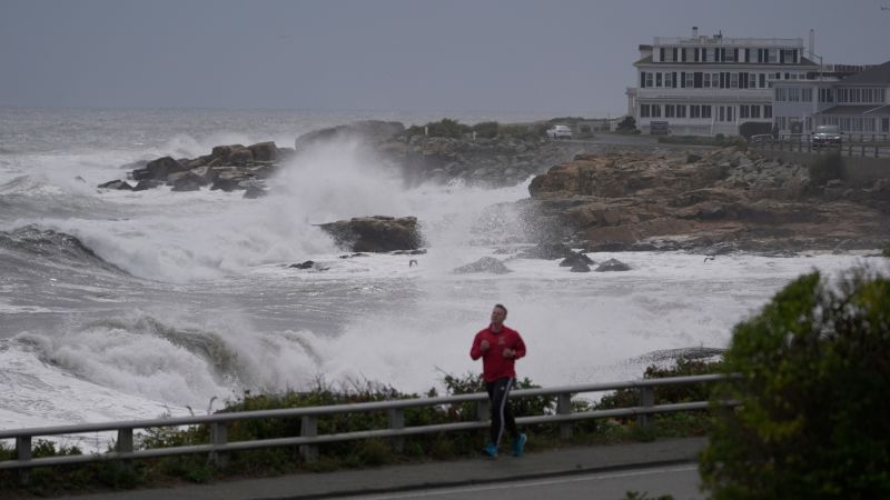
Sandego.net – An early-season nor’easter is tightening its grip on the Northeast, setting up a wet, windy and potentially damaging weekend for more than 40 million people. The storm is expected to bring persistent rain, powerful coastal gusts, dangerous surf and repeated flooding concerns from New Jersey through southern New England into Sunday.
Conditions are already deteriorating around Long Island, the New York City area and eastern Massachusetts. The system is moving northward well offshore, roughly 300 miles east of the Northeast coast, while strengthening. Its slow movement is especially concerning because it will keep rough weather focused on the region for an extended period rather than passing quickly.
Saturday Expected to Bring the Harshest Conditions
The most severe phase of the storm is forecast for Saturday, although rain, wind and tidal flooding will remain possible before and after that peak. The nor’easter is expected to linger near the coast through Monday and weaken only gradually, allowing hazardous conditions to persist across multiple high-tide cycles.
New York City could experience intervals of heavy rain along with wind gusts between 40 and 50 mph. Flooding in streets and low-lying urban locations is possible through Sunday, particularly if periods of rain overlap with rising water at high tide. Poorly drained roads may also become difficult to navigate as rainfall continues over many hours.
The storm has already affected major weekend plans across the metropolitan area. AC/DC’s Friday night concert at MetLife Stadium was moved to next week. The three-day All Things Go music festival and the annual Global Citizen Festival in Central Park were also canceled.
Coastal Gusts Could Bring Tree Damage and Power Outages
The coast from New Jersey and Long Island to southern New England is likely to face gusts of 50 to 60 mph from late Friday through Saturday night. The greatest wind threat is expected close to the shoreline south of Boston and toward Cape Cod.
Those winds are capable of toppling trees and damaging limbs, increasing the risk of power disruptions. The timing matters because many trees still have a full canopy of leaves, giving strong gusts more surface area to push against. Residents should be prepared for possible outages, blocked roads and transportation interruptions in the most exposed communities.
Boston’s emergency operations center is scheduled to be active from Friday through Monday. City officials have warned that fallen trees could create electrical problems. Ferry service in the area has been canceled for Saturday and Sunday, with some routes also suspended Friday.
Full Moon Adds to Flooding Threat
Repeated high tides will be a central concern throughout the weekend. Strong onshore winds will push water toward the coast, while Saturday’s full moon may contribute to higher-than-normal tides. From New Jersey to southern New England, the combination could produce beach erosion and coastal flooding ranging from minor impacts to major inundation in the hardest-hit locations.
Where major flooding develops, roads may become widely covered by water and flooding could reach homes and businesses. Long Island residents and business owners are preparing for the possibility that travel could be limited for several days. At Jones Beach, crews have placed large piles of sand in an effort to reinforce the shoreline and reduce flooding risk.
The storm’s unusually early arrival also means many boats remain in the water. Officials on Long Island have urged boat owners to secure vessels before the surge reaches its highest levels.
“People need to put extra lines or rope on their boat,” Town of Oyster Bay Supervisor Joseph Saladino said. “Otherwise the tide comes up, wipes your boat away. And you’ll find it a quarter mile from your house, heavily damaged.”
Rainfall May Compound High-Tide Problems
Many communities from southeastern New England southward to New Jersey are expected to receive at least 2 inches of rain. The rain is not expected to fall at exceptionally intense rates, but its duration could leave the ground saturated and create localized flooding in city streets, low spots and areas with weak drainage.
The greatest flooding risk may occur where steady rainfall coincides with high tide. Coastal water can slow drainage from inland areas, causing water to pool on roads and in neighborhoods even without a brief burst of extreme rainfall. Drivers should remain alert for flooded pavement, particularly near the coast and in urban locations.
Although the worst conditions should begin easing by Sunday afternoon, rain and gusty weather may continue into Monday as the storm gradually loses strength.
Mid-Atlantic Coast Has Already Endured Days of Rough Surf
Farther south, damaging surf, beach erosion and coastal flooding have been affecting the Mid-Atlantic coastline for several days. North Carolina, Virginia, Maryland, Delaware and New Jersey have all experienced the effects of the persistent onshore flow. Parts of southeastern Virginia and northeastern North Carolina have seen major flooding.
The prolonged nature of the event is the defining concern. Even as individual rain bands or wind gusts ease temporarily, repeated tides and continuing waves can steadily worsen erosion and push water into vulnerable coastal areas. Residents in flood-prone communities should monitor local emergency guidance, avoid driving through standing water and secure outdoor items before the strongest winds arrive.
Related Reading
Frequently Asked Questions
What is Northeast faces weekend of relentless wind?
Northeast faces weekend of relentless wind is the main topic of this guide. The article explains the context, practical details, and next steps readers should understand.
Why does Northeast faces weekend of relentless wind matter?
Northeast faces weekend of relentless wind matters because readers are looking for a useful answer, not just a short summary. Good content should match search intent and help them decide what to do next.