
Hawaii Faces Back-to-Back Tropical Storms as El Niño Shatters the Islands’ Meteorological Shield
Sandego.net – Hawaii has endured two consecutive weeks of tropical storm threats — a sequence so unusual that National Weather Service forecasters are calling it “very bizarre.” As of 5 a.m. ET on Saturday, Tropical Storm Moke sat roughly 545 miles southeast of Hilo on the Big Island, packing maximum sustained winds of 45 mph and tracking west-northwest at 8 mph. Forecasters project the system will stay at tropical-storm strength and steer well south of the island chain, yet its proximity is expected to deliver heavy rainfall and gusty winds to communities still patching up damage from the previous week’s onslaught.
The Storm That Broke the Shield
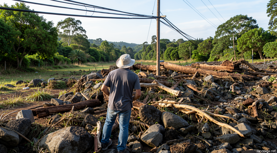
The prior week brought Hurricane Lala, which intensified while looping just south of the Big Island. Though its center never crossed the coastline, the storm unleashed torrential downpours exceeding three feet in localized areas along the windward slopes. The resulting landslides and flash floods severed access roads to small towns, leveled homes, and knocked out critical infrastructure. At least one death has been attributed to the event.
For most of the past three decades, Hawaii has enjoyed an almost uncanny immunity from direct hurricane strikes. The last time a hurricane made landfall on the islands was Hurricane Iniki, a Category 4 system that slammed Kauai from the southwest in 1992. Since then, the state has logged zero hurricane landfalls — a streak that Lala came tantalizingly close to ending before its center remained just offshore of the Big Island’s southern tip.
Why El Niño Is Rewriting the Rules
The protective barrier that has kept the islands largely untouched operates through two mechanisms: cooler ocean waters that Pacific hurricanes encounter as they drift west or northwest toward Hawaii, and strengthening upper-level winds that shear storms apart before they can organize. Tropical cyclones draw their energy from warm sea surfaces and weaken sharply when surrounding upper-level winds intensify. In a typical year, both factors conspire to degrade any storm approaching the archipelago.
The developing Super El Niño is dismantling both protections simultaneously. Warmer-than-normal sea-surface temperatures now blanket the waters east, southeast, and south of Hawaii — precisely the corridors where Pacific storms form and track toward the islands. With the fuel supply elevated and the shear environment altered, systems that would once have dissipated before reaching Hawaiian airspace are surviving long enough to threaten the coast.
El Niño also amplifies overall storm production in the Eastern and Central Tropical Pacific, raising the statistical probability that at least one system will steer toward the islands in any given season. The effect is essentially the inverse of what El Niño does to the Atlantic basin, where enhanced upper-level winds shred nascent disturbances before they can organize. That Atlantic-suppressing influence has been plainly visible this season, with weeks of near-total quiet across the North Atlantic.
A Forecaster’s Perspective on an Unprecedented Two-Week Window
Matthew Rosencrans, the lead hurricane season forecaster at the National Weather Service, emphasized that even during intense El Niño episodes, storms closing within 300 nautical miles of the Hawaiian Islands remain uncommon. The long-term annual average for such close approaches is approximately one per season.
“Very bizarre,” Rosencrans described the current two-week stretch, attributing it to a temporary alignment of atmospheric steering currents that happened to funnel successive systems toward Hawaii’s direction.
With Moke now in the picture, the state has already experienced twice its typical annual frequency of tropical cyclones passing within that 300-nautical-mile radius. Rosencrans added that a third close approach is probable at some point before the season concludes.
What Comes Next
The steering-current configuration responsible for this unusual clustering could shift on short notice, potentially offering the islands a reprieve for the remainder of the season. Still, the broader El Niño signal — warmer waters, elevated storm genesis in the central Pacific, and altered wind shear patterns — will persist through the fall, keeping the statistical odds elevated even after the immediate two-week anomaly fades.
For residents of the Big Island and neighboring islands, the practical takeaway is straightforward: the era of assuming a Pacific storm will weaken before reaching Hawaiian airspace is over for at least this season. Infrastructure hardening, updated evacuation plans, and close monitoring of both Moke’s track and any successor systems will be essential as the islands navigate the tail end of an unusually active El Niño-driven Pacific hurricane season.
Related Reading
Frequently Asked Questions
What is Two storms in two weeks?
Two storms in two weeks is the main topic of this guide. The article explains the context, practical details, and next steps readers should understand.
Why does Two storms in two weeks matter?
Two storms in two weeks matters because readers are looking for a useful answer, not just a short summary. Good content should match search intent and help them decide what to do next.