
Understanding Tornado Intensity: The Enhanced Fujita Scale Explained
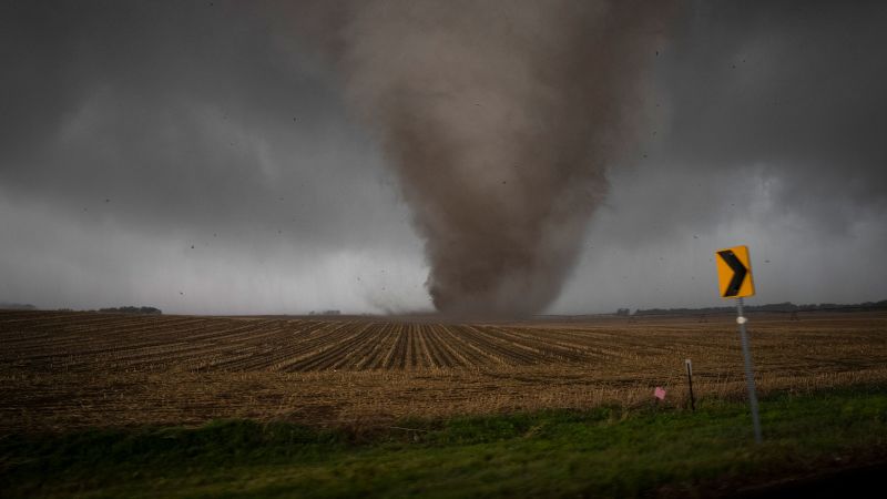
Here s how we find out how – Tornadoes, though brief and localized, play a significant role in shaping weather patterns and posing risks to communities across the United States. Each year, approximately 1,200 tornadoes are recorded, and every one of these storms receives a detailed assessment to determine its strength. This system relies on the Enhanced Fujita Scale (EF Scale), a tool developed to provide a more accurate and standardized measure of tornado impact. Unlike the traditional Fujita Scale, which was introduced in the 1970s, the EF Scale offers a refined approach to evaluating damage, ensuring that ratings reflect the true power of these violent storms.
The EF Scale: A Framework for Measuring Tornado Power
The EF Scale categorizes tornadoes into five levels, ranging from EF0 (weakest) to EF5 (most extreme), based on the intensity of the wind they produce. Meteorologists use this classification to gauge the potential destruction a tornado can cause, even though they cannot directly measure wind speeds during the storm itself. Instead, they analyze the aftermath, relying on observable damage to estimate the tornado’s strength. This method is critical because tornadoes are inherently difficult to track using conventional radar systems. Their small size and short duration—often lasting just minutes—make it challenging to capture precise data in real-time.
Damage surveys conducted by specialized teams are the backbone of this post-event evaluation. These experts visit areas affected by tornadoes to assess the types of structures and objects that were most severely impacted. By categorizing the damage, they can assign a corresponding wind speed range, which in turn determines the tornado’s rating. The EF Scale includes 28 distinct damage indicators, each representing a specific type of structure or object. These indicators range from simple farm buildings to industrial complexes, allowing for a comprehensive analysis of the storm’s effects.
The Necessity of the EF Scale: Overcoming Tornado’s Challenges
Without the EF Scale, the task of measuring tornado intensity would be far more complex. Traditional weather radar systems, while effective for tracking hurricanes and other large storms, struggle to capture the fine details of tornadoes. This limitation necessitated the creation of a more nuanced rating system, one that accounts for the unique characteristics of tornadoes. The EF Scale, introduced in 2007, replaces the original Fujita Scale and incorporates improvements that reduce subjectivity in assessments.
One of the key advantages of the EF Scale is its focus on modern construction standards. Unlike the Fujita Scale, which relied on older building materials and techniques, the new system takes into consideration contemporary engineering practices. This adjustment allows for more precise estimates of wind speeds by matching damage patterns to known structural vulnerabilities. For instance, a well-constructed barn may indicate stronger winds than a poorly built one, as the former requires higher force to collapse. Such nuances make the EF Scale a more reliable tool for tracking tornado trends and behaviors over time.
The Role of Damage Survey Teams
Damage survey teams from the National Weather Service (NWS) are essential in this process. These meteorologists collaborate with local emergency responders, such as police and fire crews, to gather information about the storm’s path and the extent of its damage. This partnership helps them create a detailed snapshot of the tornado’s impact, which is crucial for accurate assessments. In the absence of real-time radar data, survey teams turn to historical records and on-the-ground observations to reconstruct the event.
Fieldwork begins with identifying the most severe damage, as this often points to the tornado’s core strength. Teams prioritize areas where the greatest destruction occurred, using these locations as reference points for the rest of their investigation. Time is a critical factor, as communities may start cleaning up shortly after the storm passes, potentially obscuring important evidence. Surveyors must document every detail quickly to ensure their findings remain as accurate as possible.
How the Survey Process Works
Once on-site, damage surveyors systematically evaluate each indicator of destruction. They first catalog the types of structures affected, such as single-family homes, commercial buildings, or power poles. Each of these indicators is matched to a specific wind speed range based on the damage observed. For example, a completely destroyed barn might suggest wind speeds of 112 mph, while snapped trees could indicate a range of 93 to 134 mph, depending on their resilience and construction.
The process involves a series of standardized steps, beginning with the identification of the most damaging elements. Survey teams then assess the degree of destruction for each indicator, selecting from a scale of three to 12 possible levels. This step-by-step approach ensures consistency across different storms, making it easier to compare data over time. By cross-referencing multiple indicators, meteorologists can refine their estimates and arrive at a more accurate representation of the tornado’s strength.
Consider a scenario where a survey team encounters a small barn, a nearby house, and several hardwood trees. These three structures correspond to damage indicators 1, 2, and 27, respectively. The team examines the condition of each to determine the degree of damage. If the barn is entirely flattened, this signals the highest possible destruction, leading to a maximum degree of 8 out of 8. Meanwhile, snapped tree trunks might indicate a damage degree of 4, corresponding to a wind range of 93 to 134 mph. By analyzing both indicators, the team narrows down the tornado’s wind speed estimate, often identifying a central range that reflects its overall intensity.
Refining the Estimate: Collaboration and Analysis
Survey teams repeat this process until they establish a consistent maximum wind estimate. For example, if the barn was built to high standards, the wind speed might be closer to 131 mph, while a poorly constructed barn could suggest lower forces. By comparing these estimates, meteorologists can determine the tornado’s strength with greater confidence. This iterative method allows them to account for variations in construction quality and environmental factors, ensuring a more objective assessment.
Collaboration with local authorities plays a vital role in this analysis. Emergency managers and first responders provide firsthand accounts of the storm’s path, helping survey teams pinpoint key areas for inspection. This coordination streamlines the process, as it ensures that teams can access the most relevant data quickly. Additionally, the use of historical radar information enables them to validate their findings, especially when real-time data is unavailable.
The EF Scale’s impact extends beyond immediate assessments. By aggregating data from multiple surveys, meteorologists can track long-term trends in tornado activity. This information is invaluable for improving predictive models and disaster preparedness strategies. For instance, an EF2 rating, as in the example tornado, indicates wind speeds of approximately 136 to 165 mph. Such insights help communities understand the risks they face and prepare accordingly.
The Future of Tornado Rating Systems
While the EF Scale has significantly enhanced the accuracy of tornado assessments, it remains an evolving tool. Researchers continue to refine damage indicators and wind speed estimates to account for new construction techniques and changing environmental conditions. This adaptability ensures that the scale remains relevant, even as the nature of tornadoes and the structures they impact evolve over time.
Ultimately, the EF Scale serves as a critical link between the chaos of a tornado and the clarity of its rating. By combining on-the-ground observations with standardized criteria, it provides a reliable framework for understanding these powerful storms. This system not only aids in disaster response but also contributes to our broader knowledge of weather patterns and climate trends. As the NWS continues to improve its methodologies, the accuracy of tornado ratings will only increase, offering greater insight into the forces that shape our environment.